
The model provided warning about the risks of these three large fires (at second level) by detecting it in maps 10 years before.
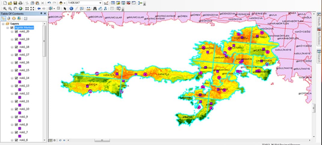
4- 02.08.2021 Muğla-Marmaris-Hisarönü (12.935 hectar) It ensured high risks at point where the fire started and technical detections regarding positions of the intervention vehicles on
5- 02.08.2021 Muğla - Köyceğiz (1629 hectar) It ensured high risks at point where the fire started and technical detections regarding positions of the intervention vehicles on
6- 02.08.2021 Muğla-Bodrum (11.898 hectar) It ensured high risks at point where the fire started and technical detections regarding positions of the intervention vehicles on